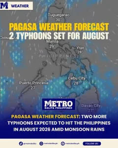
MANILA, Philippines — Following the recent passage of tropical cyclones Luis and Maymay, state weather bureau PAGASA has issued an urgent Weather Forecast warning the public to prepare for two more typhoons before the end of August 2026.
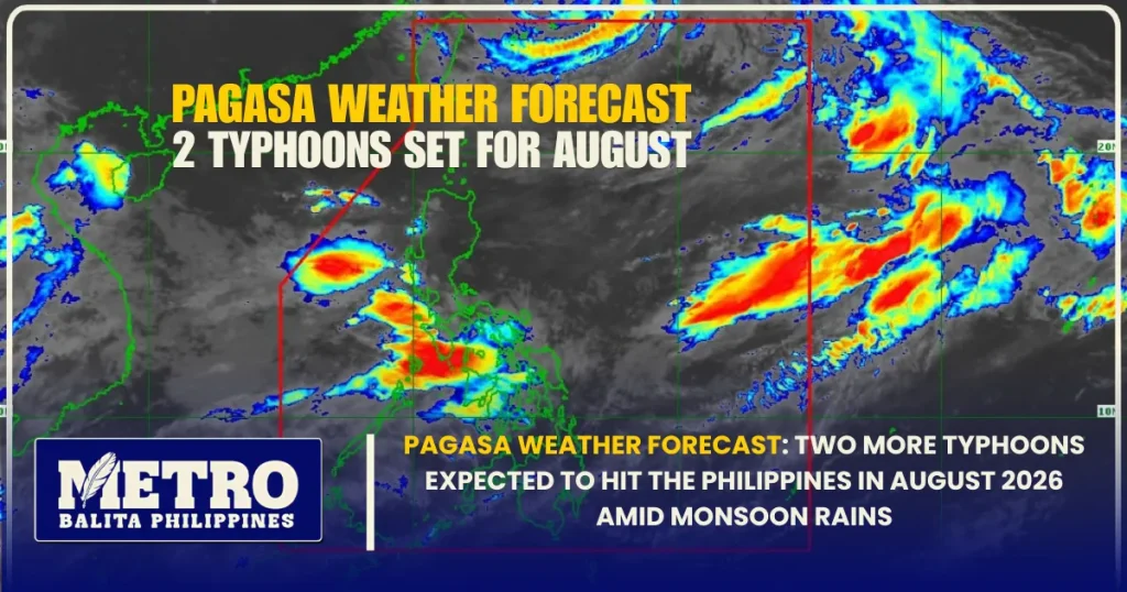
PAGASA satellite tracking showing active weather systems near PAR. Source: Facebook
According to the Philippine Atmospheric, Geophysical and Astronomical Services Administration (PAGASA), the month of August sits at the absolute peak of the country’s annual typhoon season. Meteorologists emphasized during a comprehensive public briefing on Tuesday that the latest weather forecast models indicate a total of four tropical cyclones are anticipated to enter or form within the Philippine Area of Responsibility (PAR) this month. With two storms already causing widespread flooding and severe rainfall across Luzon and parts of Visayas, weather authorities are closely tracking active low-pressure systems outside the archipelago that could quickly develop into tropical depressions within the next 24 to 48 hours.
PAGASA Official Weather Forecast Predicts Four Total Cyclones for August
In an official news briefing broadcast on Bagong Pilipinas Ngayon, PAGASA Senior Weather Specialist and Hydrologist Rosalie Pagulayan provided crucial analysis regarding current atmospheric trends. She noted that the weather agency’s monthly tracking projections remain on course as the second half of August begins.
“We are expecting four bagyos for this month. So nakakadalawa na po tayo,” Pagulayan stated, pointing out that the initial tropical cyclones of the month, Luis and Maymay, have already traversed the island region.
As part of the continuous weather forecast monitoring effort, PAGASA hydrologists and meteorologists reported that a Low Pressure Area, officially designated as LPA 08d, is currently active outside the eastern boundary of PAR. Environmental conditions over the warm waters of the Pacific Ocean remain highly favorable for storm consolidation, creating a strong likelihood that LPA 08d will mature into a full-fledged tropical cyclone shortly.
Local disaster management councils across northern and central Luzon have been advised to immediately review their community evacuation plans. The official weather forecast stresses that even if incoming systems do not make direct landfall on main landmasses, their interaction with seasonal wind patterns will trigger heavy monsoon precipitation across vast areas of the country.

Extreme Rainfall Records: Baguio City Records 1,500 mm in Heavy Downpours
The sheer intensity of recent precipitation highlights why the latest weather forecast carries such urgency for upland, low-lying, and coastal communities alike. PAGASA data revealed extraordinary rainfall totals over the past week, particularly across the Cordillera Administrative Region.
At the PAGASA monitoring station in Baguio City, hydrologists recorded a staggering cumulative rainfall of 1,500 millimeters since early August. To put this massive figure into proper context, the normal climate average rainfall for the entire month of August in Baguio is typically around 963.2 millimeters. The city surpassed its entire monthly expectation in just under a week of sustained downpours.
| Location / Metric | August Monthly Normal | Recorded Rainfall (Aug 5–11) | Climate Variance |
| Baguio City Station | 963.2 mm | 1,500.0 mm | +55.7% above normal |
| Angat Reservoir Recovery | Baseline (July 26) | +24.38 meters elevation | Critical threshold breached |
| La Mesa Dam | 80.15 m Spilling Level | 80.20 m Peak | Overflow warnings active |
According to PAGASA, moderate to heavy rainfall began intensifying significantly on August 5, although light antecedent rains had already saturated the ground earlier in the month. Weather analysts explain that when a regional weather forecast predicts additional tropical cyclones over already saturated soil, the likelihood of sudden landslides, flash floods, and severe river overflows increases exponentially.
How El Niño and the Southwest Monsoon (Habagat) Shape the Latest Weather Forecast
A primary focus of PAGASA’s updated weather forecast centers on the complex interaction between the ongoing Southwest Monsoon (Habagat) and global macro-climate drivers, including El Niño.
While El Niño is traditionally associated with prolonged dry spells and droughts across certain equatorial regions, weather specialists caution against a common misconception regarding tropical cyclone formation. Pagulayan clarified that during an El Niño phase, overall cyclone formation counts might fluctuate, but individual systems that do form often reach higher intensities and carry far denser moisture payloads.
“Hindi po natin niru-rule out ‘yung possibility kasi isa pong epekto kapag meron tayong El Niño ay maaari tayong makaranas ng mga extreme rainfall events and even ‘yung atin pong bagyo ay maaari pong malalakas din,” Pagulayan explained during the broadcast.
She added that seasonal rain trends will proceed regardless: “Pero andiyan po talaga ‘yan, like for this month, ito po ay panahon tag-ulan, panahon ng tag-bagyo.”
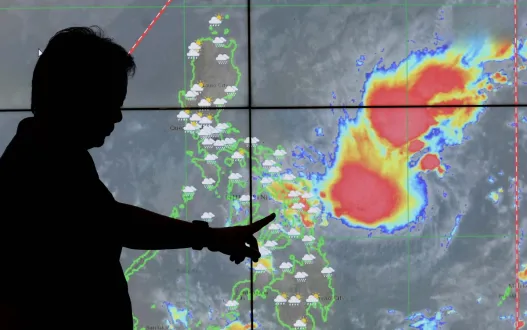
The daily weather forecast indicates that the Habagat monsoon flow will continue bringing heavy cloud cover, scattered rainshowers, and localized thunderstorms across Metro Manila, Western Visayas, and the entire western seaboard of Luzon over the coming days.
Impact on Major Water Reservoirs: Dam Levels Rise Rapidly Across Luzon
While heavy monsoon rains present serious hazards to public infrastructure and local agriculture, the downpours have provided vital relief to major water reservoirs in Luzon. Just weeks prior, municipal water authorities expressed deep concern over Angat Dam, which supplies over 90 percent of Metro Manila’s drinking water. On July 26, Angat’s water elevation dropped to its lowest recorded point of the year, dipping well below its critical operational threshold.
However, the continuous rainfall highlighted in every recent weather forecast has dramatically reversed that drop in a matter of days.
Angat Dam Hydrological Recovery
Pagulayan reported that between July 26 and August 11, Angat Dam gained nearly 24.38 meters in total water elevation. This rapid replenishment has effectively eliminated immediate water rationing fears for Metro Manila residents, though dam operators continue to carefully monitor incoming watershed runoff to prevent uncontrolled overflow situations.
Central and Northern Luzon Dam Operations
Other key impoundment facilities have experienced similar sharp increases in water volume:
- La Mesa Dam: Located in Quezon City, La Mesa Dam reached its spilling level peak of 80.20 meters. Because La Mesa lacks controlled spillway floodgates, excess water automatically overflows into the Tullahan River, prompting proactive evacuations in nearby residential barangays.
- Ambuklao and Binga Dams: In Benguet, controlled discharge operations were initiated to manage head capacity. As of Tuesday, two spillway gates were opened at Ambuklao Dam, while two gates were opened at Binga Dam.
- San Roque Dam: Hydrologists noted that Binga Dam’s continuous discharge flows directly into the San Roque Reservoir in Pangasinan. With San Roque sitting at an elevation of 260 meters, the latest weather forecast anticipates further water level increases along the lower Agno River basin.
To protect downstream communities, PAGASA’s Hydrometeorology Division has activated localized hydrological updates, sounded flood warning sirens, and deployed emergency patrol teams along river systems.
Understanding the Extended PAGASA Weather Forecast into Late 2026
Looking beyond the current month, PAGASA’s long-term climate outlook provides a roadmap for disaster risk reduction through the remainder of 2026. While the immediate weather forecast focuses on the two remaining typhoons expected this month, seasonal trends point toward changing rainfall distribution patterns:
- September 2026: PAGASA projects two to three tropical cyclones entering PAR. Below-normal rainfall is anticipated over major parts of Luzon, while above-normal rainfall may shift toward eastern Visayas and Mindanao.
- October to November 2026: Cyclone activity is expected to temper slightly to one or two tropical systems per month. A developing strong El Niño phase may lead to reduced rainfall across northern provinces.
- December 2026 to January 2027: Long-range models indicate one to two tropical cyclones in December and zero to one in January. Above-normal rainfall is expected to return to eastern Luzon with the onset of the Northeast Monsoon (Amihan).
Safety Guidelines: How Communities Should Respond to the Daily Weather Forecast
As PAGASA maintains continuous radar and satellite surveillance on incoming atmospheric disturbances, civil defense officials strongly advise residents in vulnerable zones to take immediate action:
- Monitor Official Bulletins: Check the updated weather forecast issued by PAGASA, the National Disaster Risk Reduction and Management Council (NDRRMC), and local government units (LGUs).
- Inspect Drainage and Home Structures: Clean neighborhood drainage paths, reinforce roof frames, and trim tree limbs near power lines ahead of strong wind warnings.
- Prepare Emergency Survival Kits: Keep a 72-hour survival kit packed with non-perishable food, clean drinking water, battery-powered flashlights, power banks, first-aid items, and essential family documents in sealed waterproof bags.
- Heed Early Evacuation Alerts: Residents living near mountain slopes, riverbanks, and coastal regions should evacuate promptly when ordered by authorities, especially when an updated weather forecast warns of prolonged torrential rainfall or upcoming dam water releases.
With two more typhoons projected to develop before August concludes, staying informed through a reliable weather forecast remains the nation’s primary defense against severe weather hazards. Disaster response agencies throughout the Philippines remain on high alert as atmospheric conditions continue to evolve.
Metro Balita Ph continues to deliver essential weather information.