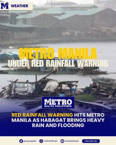
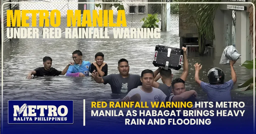
Metro Manila was placed under a red rainfall warning on Saturday, August 29, 2026, as persistent and heavy rains from the Southwest Monsoon, locally known as Habagat, affected the capital and several parts of Luzon. The red rainfall warning signaled a serious risk of flooding, particularly in areas that are already prone to rising floodwaters.
The latest weather situation has disrupted transportation, affected several roads, and raised concerns among residents as continuous rainfall pushed water levels higher in different communities. The Philippine Atmospheric, Geophysical and Astronomical Services Administration (PAGASA) warned that serious flooding could occur in flood-prone areas under the highest rainfall alert level.
As the red rainfall warning remained in effect, authorities urged residents to closely monitor official weather and flood advisories. The situation was particularly concerning because several areas had already experienced flooding before the warning was raised.
Red Rainfall Warning Issued Over Metro Manila
PAGASA issued a red rainfall warning over Metro Manila as intense monsoon rains continued across Luzon. In its 2 p.m. advisory, PAGASA listed Metro Manila among the areas under the red warning level, together with Zambales, Bataan, Pampanga, Tarlac, Bulacan, Cavite, Rizal, and parts of Batangas.
A red rainfall warning represents the most serious level in PAGASA’s rainfall warning system. It means serious flooding is possible, especially in low-lying and flood-prone communities.
The warning is not simply an indication that residents should expect rain. A red rainfall warning means communities should take immediate precautions because rainfall may overwhelm drainage systems, waterways, and other flood-control infrastructure.
For Metro Manila residents, the red rainfall warning came as many roads were already experiencing flooding and traffic congestion.
What the Red Rainfall Warning Means
The red rainfall warning is issued when rainfall conditions indicate a high possibility of serious flooding. PAGASA uses rainfall intensity and expected rainfall accumulation to determine the appropriate warning level.
Under a red rainfall warning, residents in affected areas are advised to remain alert and prepare for possible evacuation if flooding becomes dangerous. People living near rivers, creeks, waterways, and other flood-prone locations face a higher risk.
The warning also means that motorists should exercise extreme caution. Even roads that are normally passable can quickly become difficult or dangerous when rainfall continues for several hours.
Metro Manila Roads Affected by Flooding
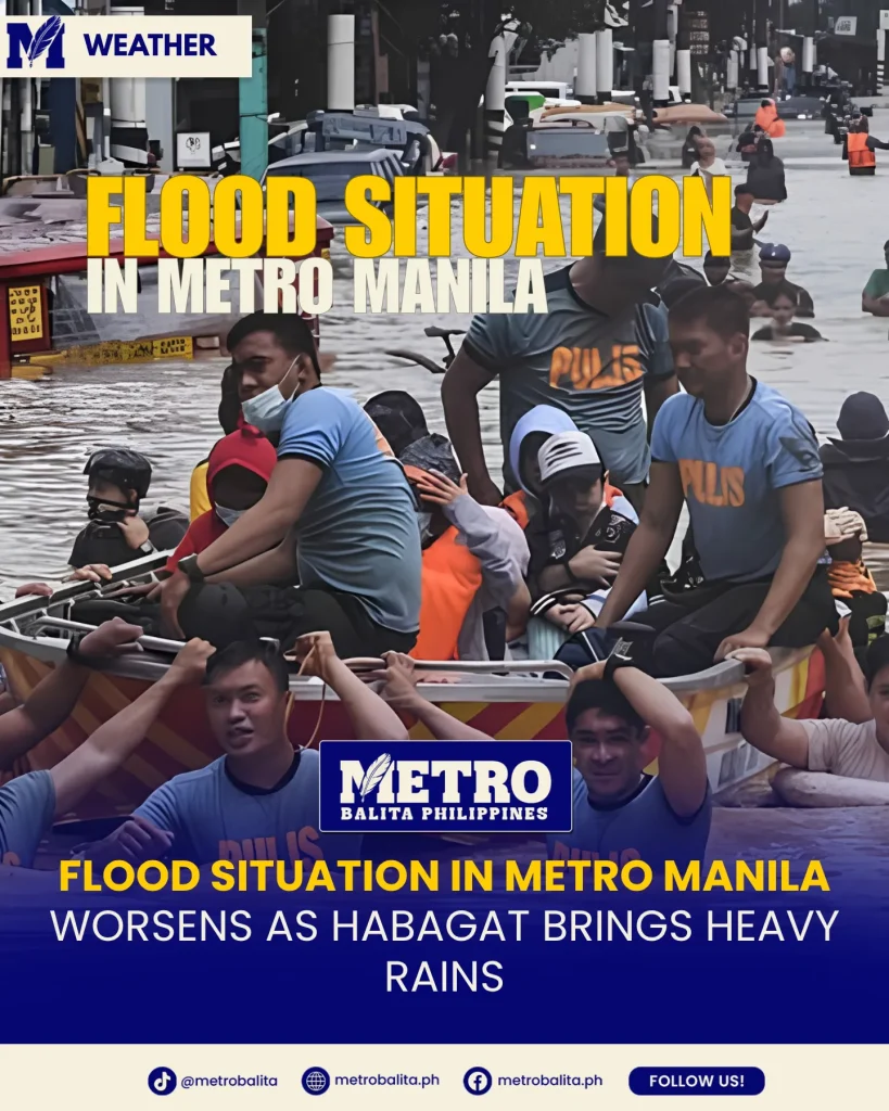
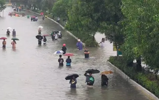
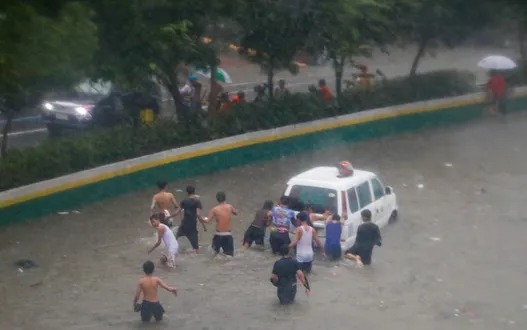
Several parts of Metro Manila were reported flooded on Saturday as heavy Habagat rains continued. The Metropolitan Manila Development Authority monitored various roads and reported traffic problems in several major areas.
Among the areas affected were portions of Las Piñas, Parañaque, Mandaluyong, Manila, Malabon, and Valenzuela.
In Las Piñas, flooding was reported around Zapote Junction, while portions of Dr. A. Santos Avenue near the SM Sucat area in Parañaque were also affected.
In Mandaluyong, flooding was reported around Boni Avenue and F. Ortigas, while parts of Taft Avenue near Quirino Avenue in Manila also experienced rising floodwaters.
Flooding was likewise reported in portions of Malabon and Valenzuela.
The continuing red rainfall warning added another layer of concern because additional rainfall could cause existing floodwaters to rise further.
Traffic Disruptions Add to the Problem
The heavy rains did not only affect residential communities. Major roads across Metro Manila also experienced traffic slowdowns.
According to MMDA monitoring, several portions of EDSA experienced moderate to slow-moving traffic. Areas including Guadalupe, Buendia, Tramo, Taft, Shaw Crossing, and Aurora Boulevard-Cubao were among those affected by traffic conditions during the rainy period.
The combination of heavy rainfall, flooded roads, reduced visibility, and increased vehicle volume made travel more difficult for commuters.
With the red rainfall warning still affecting the capital, motorists were advised to check road conditions before traveling, particularly if their routes pass through areas known to experience flooding.
Marikina River Reaches First Alarm
The continuing rainfall also caused water levels in the Marikina River to rise.
The Marikina City government raised the river to first alarm after the water level reached 15 meters on Saturday. The water level later increased to 15.2 meters, according to the city’s public information office.
The first alarm level means residents should prepare for the possibility of evacuation as river levels continue to rise.
The development is particularly important because continued rainfall can quickly increase water levels in rivers and waterways. The presence of a red rainfall warning over Metro Manila therefore prompted increased attention to communities located near the Marikina River and other waterways.
Residents in vulnerable areas were encouraged to monitor announcements from local government authorities and emergency response teams.
Habagat Is Driving the Heavy Rains
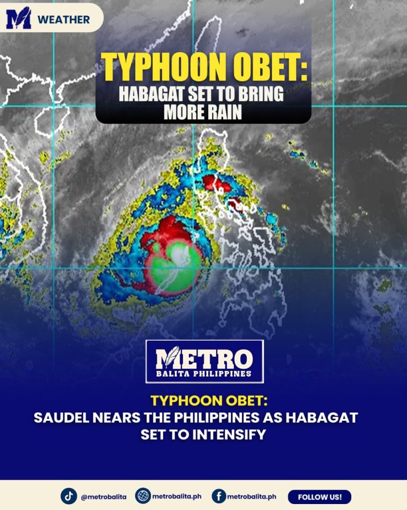
The current weather disturbance affecting Metro Manila is primarily associated with the Southwest Monsoon, or Habagat.
PAGASA said the enhanced monsoon is bringing heavy rainfall to parts of Luzon, including Metro Manila and nearby provinces. The weather agency warned that many areas could continue experiencing significant rainfall in the coming days.
Unlike a situation where a tropical cyclone directly crosses Metro Manila, the present weather pattern is largely driven by the monsoon.
However, the absence of a direct typhoon over the capital does not mean the flooding threat is minimal. Strong monsoon conditions can produce prolonged rainfall over a wide area, increasing the possibility of flooding.
The red rainfall warning demonstrates how severe the rainfall situation has become even without a tropical cyclone making landfall in the capital.
Why Habagat Can Cause Widespread Flooding
Habagat can bring moisture-rich winds toward western sections of the Philippines. When the monsoon becomes enhanced, it can produce prolonged periods of rain over Luzon and nearby areas.
For Metro Manila, extended rainfall can put pressure on drainage systems, rivers, creeks, and flood-control infrastructure.
If heavy rain continues after earlier rainfall has already saturated the ground and filled waterways, flooding can develop more quickly.
This is why authorities continue to emphasize caution whenever a red rainfall warning is issued.
More Rain Expected in the Coming Days
The weather situation is not expected to disappear immediately.
PAGASA said heavy rainfall could continue affecting parts of Luzon through Sunday and into Monday because of the Southwest Monsoon. This means residents should remain prepared even if rainfall temporarily weakens in some locations.
Temporary improvements in weather conditions do not necessarily mean the flooding threat has ended.
Under a continuing red rainfall warning, residents should continue monitoring updates because rainfall alerts can be upgraded, downgraded, or extended depending on actual weather conditions.
The prolonged rainfall also raises concerns about additional flooding in communities that have already been affected.
Government Agencies Increase Preparedness
Authorities across Metro Manila have been placed on heightened alert as the rains continue.
The Eastern Police District said it was prepared to provide assistance amid the ongoing Habagat rains. Meanwhile, Manila’s city government placed its hospitals under Code White status as heavy rainfall affected the capital.
The Pasig River Ferry service was also suspended on August 29 because of the unfavorable weather conditions.
These measures reflect the broader impact of the red rainfall warning on public safety and transportation.
Local governments are also expected to continue monitoring flood-prone communities and waterways as rainfall persists.
Residents Urged to Take Flood Precautions
Residents in affected areas should take the red rainfall warning seriously, especially those living in low-lying locations.
People should avoid walking or driving through flooded roads when possible. Floodwater can hide open manholes, damaged roads, electrical hazards, and other dangers that may not be visible from the surface.
Residents near rivers and waterways should also pay close attention to local evacuation announcements.
Important documents, medicines, mobile phones, chargers, drinking water, food, flashlights, and other emergency supplies should be kept in a location where they can be quickly retrieved if evacuation becomes necessary.
During a red rainfall warning, it is also advisable to avoid unnecessary travel. Staying indoors may be safer than attempting to cross flooded roads.
What Residents Should Watch For
The red rainfall warning is only one part of the overall flood risk assessment. Residents should also monitor river levels, local government announcements, evacuation notices, and updates from PAGASA.
Those living near waterways should pay particular attention to rapidly rising water.
If floodwaters begin entering homes or communities, residents should not wait until the situation becomes life-threatening before moving to a safer location.
Parents should also keep children away from floodwaters. Strong currents can develop even in areas where flooding initially appears shallow.
Motorists should likewise avoid flooded roads whenever alternative routes are available.
Red Rainfall Warning Remains a Major Public Safety Concern
The latest weather developments show that the red rainfall warning is more than a routine weather advisory. It reflects a serious flooding threat created by persistent and heavy rainfall across Metro Manila and surrounding areas.
With several roads already flooded, the Marikina River reaching first alarm, transportation services disrupted, and heavy rainfall expected to continue, residents remain at risk of further flooding.
The situation also highlights the importance of following official warnings rather than relying solely on personal observations of rainfall. A neighborhood may appear relatively safe while nearby rivers or drainage systems are already approaching dangerous levels.
For communities under the red rainfall warning, preparedness remains essential.
Stay Updated as Weather Conditions Develop
The weather situation across Metro Manila and parts of Luzon remains dynamic. PAGASA may update rainfall warnings as conditions change, while local governments may issue separate announcements regarding flooding, evacuations, road closures, and transportation.
Residents should continue checking official PAGASA bulletins and announcements from their respective local government units.
The red rainfall warning should serve as a reminder that flooding can worsen quickly when heavy rainfall continues.
As Habagat remains active, residents are encouraged to stay alert, avoid unnecessary travel, prepare emergency supplies, and follow evacuation instructions when issued.
For now, the priority remains public safety as Metro Manila and surrounding areas deal with another episode of intense monsoon rainfall and widespread flooding.
Metro Balita Ph continues to deliver essential weather information.