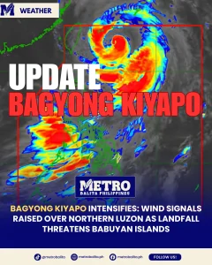
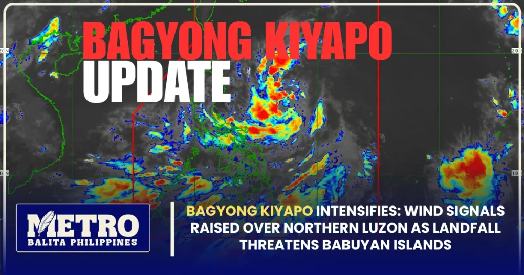
Residents and local disaster response authorities across Northern and Central Luzon are bracing for severe weather conditions as Tropical Storm Kiyapo continues to gain strength while tracking northwestward over the Philippine Sea. According to the state weather bureau, tropical cyclone wind signals have been officially hoisted across multiple northern provinces to warn vulnerable communities of high winds, intense rainbands, and dangerous sea conditions. In this detailed bagyong kiyapo update, state meteorologists warn that the tropical cyclone could escalate into a severe tropical storm prior to its expected exit from the Philippine Area of Responsibility (PAR) on Saturday morning.
The Philippine Atmospheric, Geophysical and Astronomical Services Administration (PAGASA) confirmed that Kiyapo, which originally organized as a tropical depression, intensified into a tropical storm early Friday. As the system draws closer to extreme Northern Luzon, disaster risk reduction and management councils across national and municipal levels have been placed on high alert to coordinate emergency responses, monitor river basins, and manage potential landslides and coastal flooding.
Latest Bagyong Kiyapo Update: Wind Signals and Storm Track
In a formal weather briefing issued at 5:00 AM on Friday, July 24, 2026, PAGASA weather specialist Obet Badrina detailed the cyclone’s movement, intensity, and projected path. Based on the 4:00 AM satellite tracking data, the eye of Tropical Storm Kiyapo was centered approximately 345 kilometers east of Aparri, Cagayan. The storm is currently moving in a west-northwestward direction at a relatively rapid speed of 30 kilometers per hour (km/h).
Kiyapo currently packs maximum sustained winds of 65 km/h near its center, with gustiness reaching up to 80 km/h. Forecasters emphasize that because the cyclone is traversing favorable warm oceanic waters, environmental conditions remain conducive for sustained intensification over the next 24 hours.
“So, before it exits the Philippine Area of Responsibility early tomorrow morning, it could intensify into a severe tropical storm; this means the Tropical Cyclone Wind Signal raised could go up to Signal No. 3,” Badrina reported during the morning broadcast.
Given this continuous development, monitoring every official bagyong kiyapo update is essential for coastal and mountain communities along the storm’s path. PAGASA indicated that Kiyapo is projected to make a close approach to or execute a direct landfall over the Babuyan Group of Islands as it navigates the northern maritime boundary of the country.

Detailed Breakdown of Tropical Cyclone Wind Signals
To help local government units and residents prepare effectively, PAGASA has expanded storm warnings across vast stretches of Luzon. The state weather agency officially raised Tropical Cyclone Wind Signal No. 2 and Signal No. 1 in several coastal and inland areas.
Areas Placed Under Wind Signal No. 2
Provinces designated under Signal No. 2 are expected to experience gale-force winds within the next 24 hours. These atmospheric forces present minor to moderate threats to structures, capable of unroofing light houses, uprooting trees, and causing agricultural damage:
- Batanes
- Northern portion of Mainland Cagayan, including the Babuyan Islands
- Northern portion of Ilocos Norte
Areas Placed Under Wind Signal No. 1
Areas under Signal No. 1 may experience strong winds within 36 hours. While structural damage is generally minimal, coastal and elevated terrain are highly exposed to sudden, powerful gusts:
- The rest of Mainland Cagayan
- Isabela
- Nueva Vizcaya
- Quirino
- Apayao
- Abra
- Kalinga
- Mountain Province
- Ifugao
- Benguet
- The rest of Ilocos Norte
- Ilocos Sur
- La Union
- Northern and central portions of Aurora
Disaster relief coordinators reviewing the bagyong kiyapo update emphasize that local disaster management offices under Signal No. 2 should immediately clear urban drainage channels, inspect temporary shelters, and prepare emergency evacuation assets for high-risk neighborhoods.
Babuyan Islands Landfall Scenario in the Bagyong Kiyapo Update
Forecasters note that while meteorological models closely trace the storm’s core, slight changes in environmental pressure could still alter the exact point of landfall. However, current projections place the island chain north of Mainland Luzon directly inside the storm’s path.
According to PAGASA, the center of Tropical Storm Kiyapo is navigating within a forecast cone of probability that severely threatens the Babuyan Group of Islands. “The storm’s center could pass within the cone of probability, meaning it may make landfall on any of the islands in the Babuyan Islands. It could also pass close to the islands without making landfall,” Badrina explained.
Even in a non-landfall scenario where the center remains offshore, the broad extent of Kiyapo’s cloud coverage guarantees severe downpours and strong wind gusts across Northern Luzon. Consequently, staying attentive to each released bagyong kiyapo update enables regional authorities in Cagayan and Batanes to implement preemptive sea travel suspensions and protect vulnerable coastal settlements.
Monsoon Enhancement and Nationwide Weather Impact
While extreme Northern Luzon prepares for direct impacts, central and southern provinces are facing significant monsoon rainfall. A critical component highlighted in the latest bagyong kiyapo update is the cyclone’s role in pulling and intensifying the Southwest Monsoon, locally known as Habagat.
As Kiyapo tracks northwestward, it actively pulls moist, heavy air across the Philippine archipelago. This interaction generates thick cloud clusters that bring monsoon rains over the western seaboards of Luzon, the Visayas, and portions of Mindanao. PAGASA forecasters caution that rainshowers, overcast skies, and localized thunderstorms will persist throughout the weekend, even after the cyclone exits the northern boundary of PAR.

Regional Breakdown of Monsoon Conditions
- Western Sections of Northern and Southern Luzon: Heavy, continuous downpours are expected over Occidental Mindoro and Palawan.
- Western Visayas: Occasional heavy rains threaten low-lying farming communities in Antique, Iloilo, Guimaras, and Negros Occidental.
- Mindanao and Central Luzon: Overcast skies accompanied by scattered thunderstorms raise flash flood warnings in river basins.
Badrina noted that the cloud expanse from both the typhoon and the monsoon is wide enough to cover large parts of the country. As a result, soil saturation levels across mountainous regions are rising, significantly increasing the probability of sudden landslides.
Maritime Hazards and Dangerous Sea Conditions
Sea travel across the northern maritime domain of Luzon has been declared hazardous as sea conditions deteriorate due to Tropical Storm Kiyapo and the enhanced monsoon winds.
PAGASA’s marine weather advisories urge extreme caution along coastal waters:
- Batanes and Babuyan Islands Seaboards: Waves are reaching heights between 3.1 meters and 5.5 meters, generating rough to very rough sea conditions. Small sea craft face severe risks of capsizing.
- Northern Cagayan and Ilocos Norte Seaboards: Wave heights are estimated between 2.8 meters and 5.0 meters, creating hazardous navigation conditions for commercial and fishing vessels.
Fisherfolk, operators of small motorboats, and inter-island passenger ferries are strongly urged to suspend sea operations in affected northern seaboards. Adhering to the marine advisories outlined in the bagyong kiyapo update is crucial to preventing maritime accidents and protecting lives.
OCD Assessment: 6,947 Barangays at Risk of Flooding and Landslides
In response to the combined threats of Tropical Storm Kiyapo and the enhanced monsoon, the Office of Civil Defense (OCD) conducted detailed hazard evaluations to identify communities at risk.
In a risk statement released alongside the bagyong kiyapo update, the OCD alerted that 6,947 barangays across Northern, Central, and Southern Luzon face moderate to severe threats of flooding and soil instability.
Key Risk Areas Identified:
- Cordillera Administrative Region (CAR): Mountain provinces including Benguet, Ifugao, Mountain Province, and Kalinga are highly vulnerable to rain-induced slope failures along major road corridors.
- Cagayan Valley (Region II): Villages near the Cagayan River basin face rising water levels due to runoffs from surrounding mountain ranges.
- Ilocos Region (Region I): Coastal and riverbank communities face simultaneous threats from river swells and rough coastal surges.
- Western Visayas (Region VI): Monsoon-driven downpours threaten low-lying agricultural areas with widespread flooding.
The OCD has instructed regional disaster councils to activate Pre-Disaster Risk Assessment (PDRA) protocols, preposition emergency relief packs, and coordinate early evacuation plans with local government executives.
Local Government Preparedness and Emergency Response Actions
Bagyong kiyapo update Across Northern Luzon, local chief executives have mobilized disaster response units to protect communities from the storm’s impact. Provincial disaster offices in Cagayan, Batanes, and Ilocos Norte have prepared evacuation centers equipped with sanitation kits, food packs, and clean drinking water supplies.
Heavy machinery and rescue teams have been deployed along major highways in the Cordillera region to quickly clear potential landslides and ensure emergency supply routes remain open. Furthermore, coastal towns are monitoring sea conditions to enforce strict no-sail policies for local fishermen. Municipal social welfare departments are also assisting vulnerable families living near riverbanks and steep hillsides as preemptive evacuations begin.
Public Safety Guide and Disaster Preparedness Steps
With Tropical bagyong kiyapo update advancing toward Northern Luzon, public safety remains the top priority. Emergency management agencies urge all residents in affected provinces to observe the following safety measures:
- Follow Official Weather Bulletins: Stay informed by listening to every verified bagyong kiyapo update broadcast by PAGASA, the OCD, and municipal disaster pages. Avoid spreading unverified rumors on social media platforms.
- Inspect and Secure Homes: Reinforce loose roof sheets, secure doors and windows, clear roof gutters, and trim tree branches near power lines or roofs.
- Prepare an Emergency Go-Bag: Ensure every household has a waterproof emergency kit containing non-perishable food items, bottled drinking water, a first aid kit, flashlights, extra batteries, fully charged power banks, essential prescription medicines, and important personal documents.
- Comply with Preemptive Evacuation Orders: If local government officials issue evacuation alerts due to rising floodwaters or landslide risks, move to designated evacuation centers immediately while travel routes remain safe.
- Avoid Flooded Roads and Rivers: Do not attempt to wade, swim, or drive through floodwaters. Fast-flowing currents can easily sweep away vehicles and pedestrians.
Storm Outlook and Expected Exit from PAR
According to PAGASA’s tracking model, Tropical Storm Kiyapo will continue moving west-northwestward at a speed of 30 km/h. If it maintains its current speed and direction, the cyclone will pass close to or over the Babuyan Islands during the day on Friday before exiting the Philippine Area of Responsibility by Saturday morning, July 25.
However, state meteorologists emphasize that the storm’s departure from PAR does not mean an immediate return to fair weather. Because the enhanced Southwest Monsoon will continue to pull moisture across Luzon and the Visayas, overcast skies, frequent rainshowers, and localized thunderstorms are expected to persist through Sunday.
As local government units maintain high operational readiness, following every official bagyong kiyapo update remains the most effective defense against storm hazards. Residents across Northern Luzon and monsoon-affected provinces are urged to remain vigilant, prioritize personal safety, and strictly follow the guidance of local emergency authorities.
Metro Balita Ph continues to deliver essential weather information.