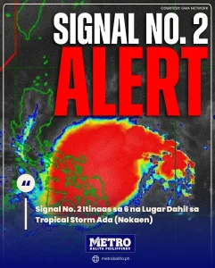
Tropical storm ada (nokaen) continues to be closely monitored as weather authorities raised Tropical Cyclone Wind Signal (TCWS) No. 2 over six areas in the country. According to PAGASA, the storm has maintained its strength while hovering over the coastal waters of Catanduanes, prompting stronger warnings for communities in its path.
Based on PAGASA’s 11 a.m. bulletin, TCWS No. 2 means winds of more than 62 kph up to 88 kph may be experienced within at least 24 hours. These conditions can cause minor to moderate damage, especially to light structures, power lines, and trees.
Areas Under Tropical Cyclone Wind Signal No. 2
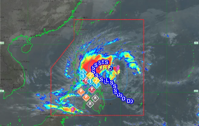
The following areas were placed under TCWS No. 2 due to the effects of tropical storm ada (nokaen):
Luzon
- Eastern portions of Camarines Norte, including Vinzons, Daet, Mercedes, Basud, and nearby towns
- Eastern and central portions of Camarines Sur, including Naga City, Iriga City, Pili, Goa, Lagonoy, Caramoan, and several municipalities
- Catanduanes
- Albay
- Sorsogon
Visayas
- Northern Samar
PAGASA warned that gale-force winds in these areas may lead to flying debris, rough seas, and temporary power interruptions. Coastal communities are especially at risk due to strong winds and high waves.
Areas Under Tropical Cyclone Wind Signal No. 1
Meanwhile, TCWS No. 1 was raised in several other areas, where winds of 39 to 61 kph may be expected within at least 36 hours, along with intermittent rains.
Luzon
- Eastern portion of Quezon Province, including Polillo Islands
- Marinduque
- Eastern portion of Romblon
- Remaining areas of Camarines Norte and Camarines Sur
- Masbate
Visayas
- Eastern Samar
- Samar
- Biliran
- Northern portion of Leyte, including Tacloban City and Ormoc City
- Northern portion of Cebu, including Bantayan Islands
Under TCWS No. 1, minimal to minor impacts from strong winds are possible, such as broken tree branches and rough sea conditions for small vessels.
Current Location and Strength of the Storm
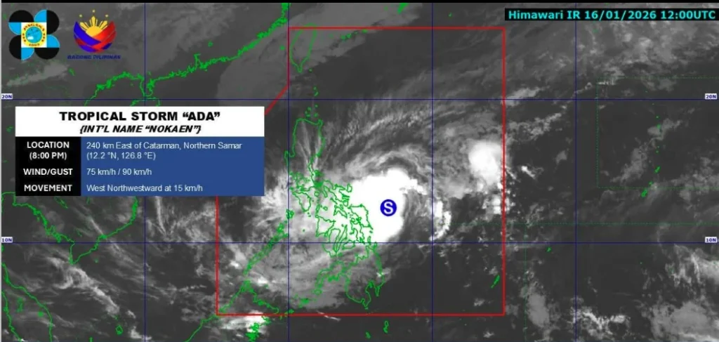
As of the latest update, the center of tropical storm ada (nokaen) was located over the coastal waters of Baras, Catanduanes. The storm is moving northwestward at a speed of 25 kph, with maximum sustained winds of 85 kph near the center and gusts reaching up to 115 kph.
Aside from the storm itself, PAGASA also noted that the Northeast Monsoon, or Amihan, combined with Ada’s outer circulation, may bring strong to gale-force gusts in several areas. These include Batanes, Babuyan Islands, Ilocos Norte, Cagayan, Isabela, Aurora, Quezon, parts of Visayas, and the Dinagat Islands, especially in coastal and upland locations.
Track and Intensity Outlook
Weather forecasters said Ada is expected to continue moving northwestward before slowly turning north to northeast on Sunday. From then on, the storm may move in a looping pattern over the sea east of Southern Luzon. PAGASA also warned that a slight change in its track could lead to a possible landfall over Catanduanes.
While Ada is forecast to remain a tropical storm in the coming days, further intensification into a severe tropical storm is still possible. Because of this, the raising of TCWS No. 3 cannot be ruled out. By Tuesday, January 20, Ada is expected to weaken into a tropical depression due to the effects of the Northeast Monsoon.
Class Suspensions and Preparations
Due to bad weather brought by tropical storm ada (nokaen), classes on Saturday, January 17, 2026 were suspended in several areas. Authorities are also urging residents to prepare emergency supplies, avoid unnecessary travel, and follow evacuation orders if issued.
The Office of Civil Defense added that extra precautions are needed in Albay because of the combined risks from the storm and the ongoing unrest of Mayon Volcano.
As the situation develops, the public is strongly advised to stay updated through official weather bulletins and local government announcements. Metro Balita Ph will continue to provide timely updates on Tropical Storm Ada and its possible impacts.